Long horizons, route history, and northwestern distance.
Sample Route · Expeditions
Silk Roads and Desert Frontiers.
A longer northwest route shaped by cave temples, corridors, desert light, and frontier towns. It is a sample direction, then tailored around season and pace.


Needed to move across the corridor without collapsing the route into transit.
For clearer skies, manageable temperatures, and more forgiving road days.
A route for travelers who can handle distance but still want good structure.
Why This Route
A route that opens China westward.
This sample is about horizon, exchange, and scale. It is one of the strongest routes for travelers who want historical depth but do not want only capitals and gardens. The road itself matters here, so the pacing has to be designed with real care.
Silk Road
Desert
Frontier Towns
Cave Temples
Route Shape
How the sample route unfolds.
The corridor works best when it opens gradually, not all at once.
Enter the Northwestern Corridor
The route begins with easier urban entry and the first shift toward the frontier line.
Forts, Passes, and Corridor Scale
Historic outposts, larger sky, and the first real feeling of distance between stops.
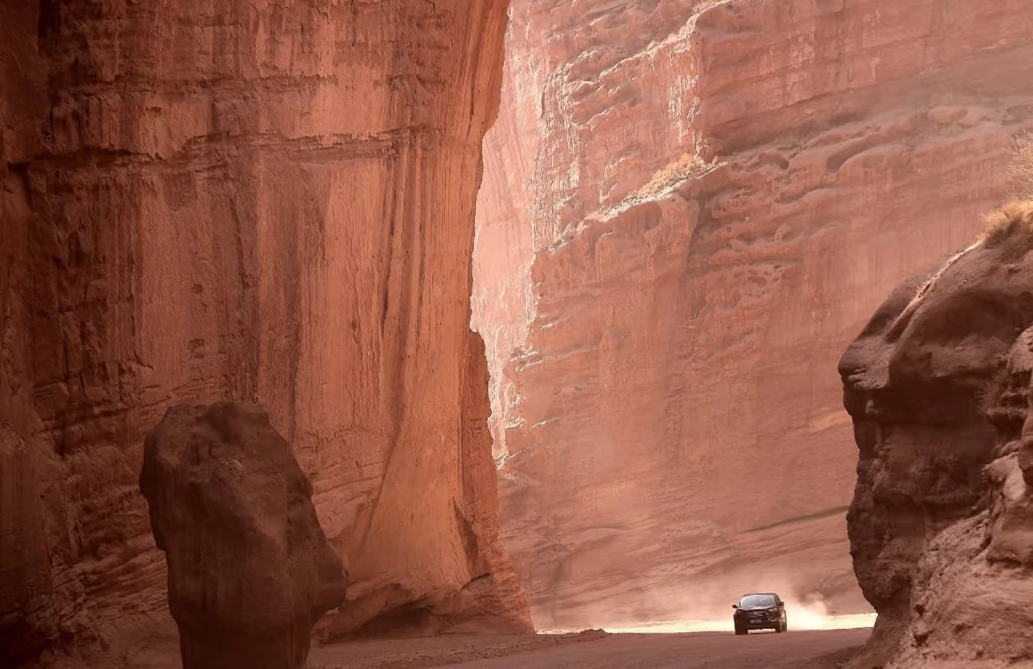
Cave Temples and Desert Light
A richer middle section where route history and physical landscape begin to merge.
Frontier Finish
One last longer arc through dunes, road landscapes, and a controlled close to the trip.
What Stands Out
Historical scale
The route reveals how trade, movement, and frontier geography shaped China from the outside in.
Very strong visual range
Dunes, passes, desert edge, and cave sites make the trip visually unlike eastern China.
Distance with narrative
Every long movement has a clear role in the route rather than being empty transit.
What We Usually Adjust
Route Length
Shorter corridor versions are possible, but the right cut matters.
History Weighting
More archaeology and sites, or more landscape and road atmosphere.
Travel Intensity
More flights, more trains, or a route that leans into the overland feeling.
What You Get
The northwest, made legible.
Best for travelers who want China to feel wider, older, and more open-ended.
Extremely high, especially through long-road atmosphere, desert edge, and frontier geology.
Strong historical density, especially for travelers interested in trade routes and civilizational exchange.
High. The farther west the route goes, the more valuable good sequencing and practical support become.
Best Fit & Customization
Use this route when the traveler wants China to open westward.
The final version can be more historical, more scenic, shorter, or more overland.
Clients drawn to cave temples, desert light, frontier towns, and long-route atmosphere.
Shorten the corridor, add archaeology depth, increase desert time, or smooth transit with flights.
Transport logic, guide coordination, hotel sequencing, and contingency planning keep the route coherent.
Support On The Road
Distance is part of the route. So is support.
Northwestern travel feels very different when the practical layer is handled well.
Long-Route Planning
We shape the sequence so the corridor opens instead of exhausting the traveler.
Transport Logic
Flights, trains, and road segments are chosen for coherence, not just speed on paper.
Local Problem Solving
The farther the route extends, the more important responsive coordination becomes.
Next Step
Use this route if the northwest is part of the dream.
We can keep the road feeling, shorten the distance, or push harder into history, dunes, and frontier atmosphere.