Altitude, distance, and a route where support matters as much as beauty.
Sample Route · Expeditions
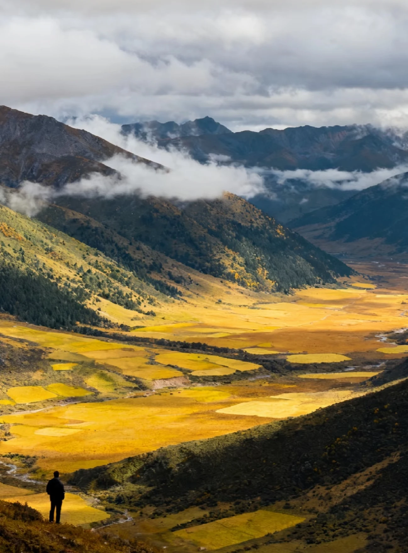
Trails of West Sichuan.
A highland sample route through valleys, monasteries, grasslands, and altitude. It requires stronger support and is always shaped carefully to the traveler.


Needed for acclimatization, spacing, and a route that does not rush the plateau.
Clearer weather windows and more comfortable hiking conditions.
For travelers who want nature and distance, but not chaos.
Why This Route
A serious landscape route with cultural depth.
West Sichuan works when the traveler wants nature, altitude, and a different rhythm of China entirely. The route can be highly rewarding, but only if it respects acclimatization, transfer logic, and the difference between ambition and exhaustion.
West Sichuan
Highlands
Monasteries
Trails
Route Shape
How the sample route unfolds.
More than a trail list. The order is what makes the route workable.
Start in Chengdu
Ease in, set logistics, and prepare the route before the elevation begins to change.
Climb into the Highland Corridor
Kangding-side movement, grasslands, monastery regions, and the first real sense of altitude.
Valleys, Village Time, and Trails
A longer middle section where landscapes, walking, and local encounters carry the trip.
Highland Finish and Return
One last stronger landscape movement, then a controlled descent back toward departure.
What Stands Out
Big landscape, real distance
This is one of the clearest ways to feel how large western China really is.
High reward, higher planning need
The route is memorable because it enters a different physical and cultural world.
Active but shapeable
Walking can be light, moderate, or stronger depending on appetite and altitude response.
What We Usually Adjust
Altitude Management
More adaptation time, lower sleeping elevations, or a less aggressive sequence.
Walking Intensity
Scenic drives with short walks, or a route with stronger trail ambition.
Comfort Level
Property selection, recovery nights, and support where the route needs it most.
What You Get
A more ambitious China, without losing your footing.
Best when travelers want the western highlands but do not want to self-manage every risk.
Extremely high. Open valleys, plateau light, monastery regions, and wide mountain weather.
Strong, especially through western Tibetan cultural regions and village encounters.
High. This is where route design, logistics, and on-trip problem solving matter visibly.
Best Fit & Customization
Use this route when the traveler wants western China with real support.
The final version can be more active, more cultural, or more comfort-forward.
Clients who want highlands, monasteries, open valleys, and distance without self-managing every risk.
Adjust sleeping elevations, trail intensity, recovery nights, vehicle comfort, and cultural time.
Route sequencing, local guides, weather decisions, and on-trip support matter visibly here.
Support On The Road
This route depends on support being real.
That is the difference between memorable and needlessly hard.
Altitude & Pace
We watch the route shape closely so the trip stays ambitious but manageable.
Guide & Route Logic
Road conditions, stop sequencing, and daily decision-making are part of the service, not afterthoughts.
Contingency Handling
Weather, energy, and local conditions can change. The route needs room to adapt well.
Next Step
Use this route if western China is the reason to come.
We can make it more trail-led, more cultural, easier-paced, or more comfort-forward without losing the highland feeling.